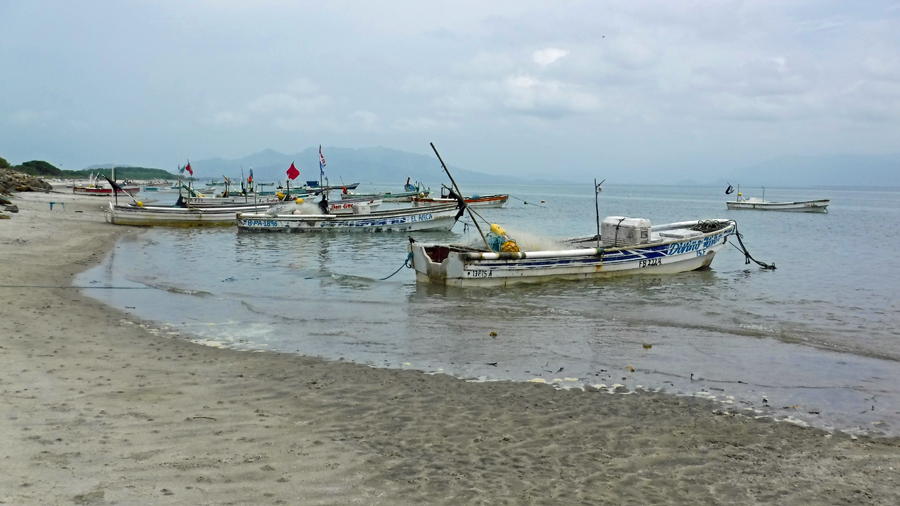
Fishing boats at Punta Chame
Moving from the Caribbean closes the book on a chapter of our wacky sailing adventure. Our passage through the canal wasn’t exactly an easy decision to make. The decision mostly evolved from a lack of wanting to continue to cruise the Caribbean islands. If you are a regular reader of this blog, you already know we tend to move very slowly. Once we find a place we like, we stay and we explore. When we find a spot we are not fond of, we move on quickly. Because of our lengthy stays and exploration in previous destinations, we have no desire to return to places we’ve already visited. Some other cruisers return to the same islands year after year. There is no right way or wrong way of doing this. This is just our way.
Cindy and I discussed looping back around the Caribbean one more time. However, quite frankly we were pretty tired of the eastern islands and didn’t see any point of returning. Don’t get me wrong. There are some spots we both absolutely loved and feel fortunate regarding our experiences. An opportunity to revisit places like Îles des Saintes or Bonaire again was very tempting. We much more enjoyed the southern and western Caribbean locations over the eastern islands. We agreed when we departed these locations we were ready to leave and felt we’d seen all we wanted to see. So, why go back? Not wanting to go back raises another question, where to next? And, this is the question we now face.
On the Caribbean side of Panama we are well out of the hurricane belt for this summer but in the heart of the lightning belt. During the last few days of our stay in Shelter Bay Marina we saw crazy electrical storms and waterspouts. And, this is just the beginning of the rainy season. Cindy did a ton of research on Panama and found the weather on the Pacific side is not as nasty as on the Caribbean side during the summer. This information further solidified in our decision to change oceans.
Coming through the canal changed a few things for us. We are unfamiliar with most of the options we now have and need to do some homework. Should we head north to Costa Rica, Nicaragua, Honduras, Guatemala, Mexico and perhaps the west coast of the USA? There is a group called the Panama Posse that does this and we are moored with many of them now. They are a really great group of people who are outgoing and openly welcome outsiders to their group. It might be really fun to tag along with them for a little while. Should we travel south to Ecuador, Peru and Chile? Or, should we travel westward to the Galapagos and French Polynesia and beyond? The French Polynesian Islands are calling us but it is a really long way to sail. It’s thousands of miles. Do we really want to spend four weeks crossing an ocean? Is it going to be worth it when we get there? We need to understand more about sailing seasons and routes in these areas before we can decide on a direction. This is fine. We have plenty of time. We are going to stay put in Panama for a little while and figure it out. So now we are beginning to write chapter two of our tale. We both feel a little bit lost.
Today, we are leaning toward heading west. This decision changes with almost every conversation. Tomorrow might be a different thought. I know us; when we do eventually make up our minds there will be a commitment to the decision.
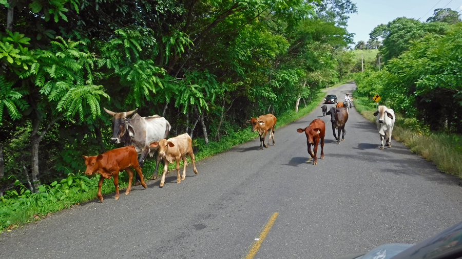
Driving on the rural roads, we never know what is around the corner
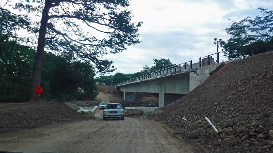
The bridge was under repair and detour took us off-road over an earthen one-lane bridge – probably not a good idea in the rain. Note the lack of guard rails.
Meantime in Panama, speaking of feeling lost, we rented a car and have begun to explore Panama City and surrounding areas. It has been a long time since we have had access to a big city and its offerings. Like any boat owner we have a list of things the boat needs. The quick solution would be to order from familiar stores the USA and pay the extra fees to have items shipped to us. But, who needs the quick solution. We have time to find our way about.
Venturing out from our marina, we find ourselves in stark contrast to our locations over the past few months. Just a month ago, we were happy when the veggie boat showed up and we could buy some food. In the San Blas islands of Panama, the sparse Kuna population have little needs. Almost all of them still live without electricity (willingly). Back then, we were thrilled when given the chance to buy a few tomatoes and potatoes. Now all of a sudden we find ourselves in a shopping mall with marble tiled floors and shops selling a single pair of shoes for the price a Kuna person could feed an entire family for a year. We have hardware stores, giant supermarkets and lots of restaurants again. I struggle sometimes to determine which lifestyle I prefer. The life of the Kuna was peaceful, stress free and with almost no possessions. On this side of Panama we have traffic jams and shopping malls.
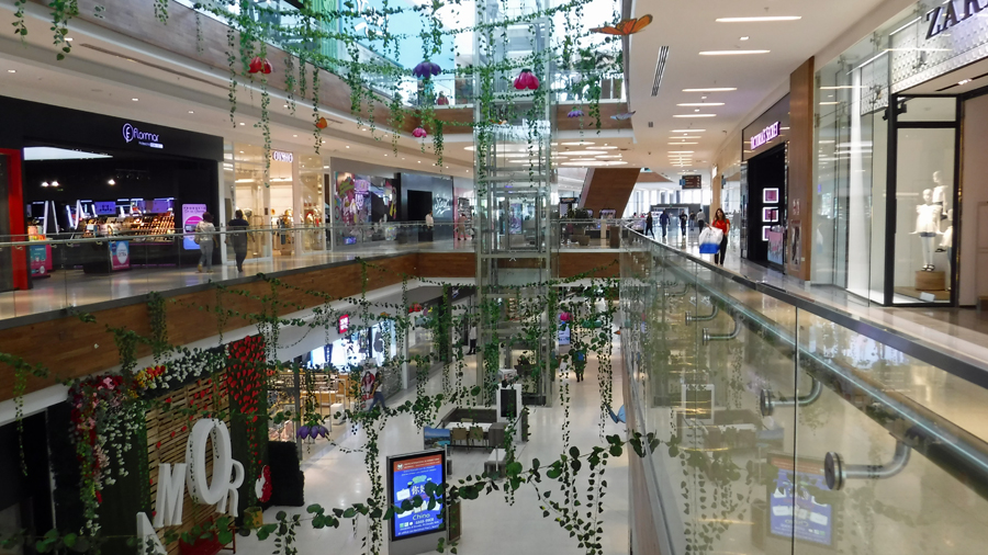
One of the many malls in Panama City
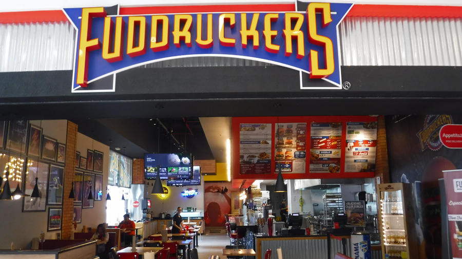
OMG! So happy to find this place at lunchtime. Yum!
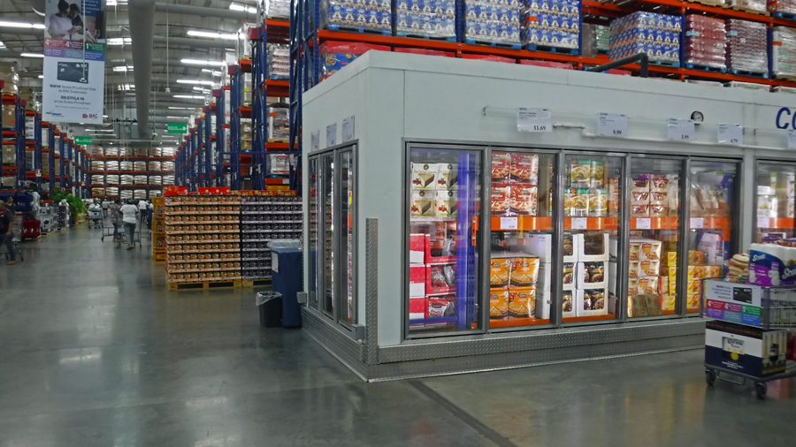
We found PriceMart – It is just like Costco. I mean, just like Costco. We are now members of PriceMart. We’re so happy!
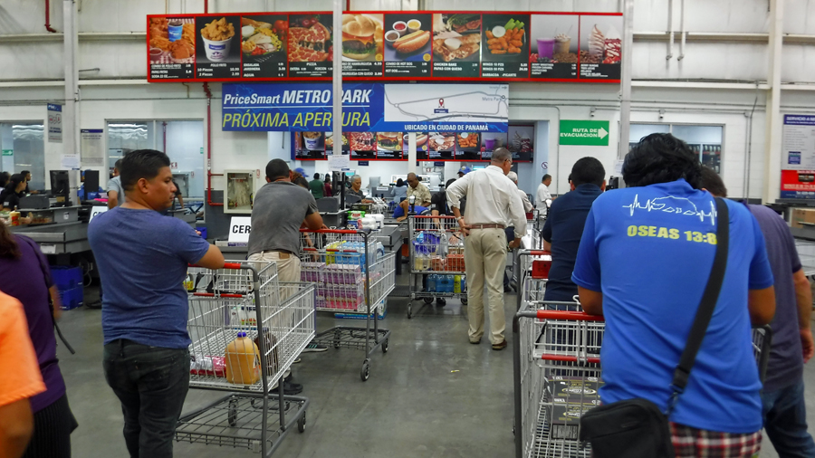
They even have lines like Costco and cheap hot-dogs
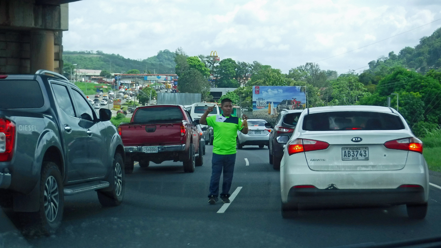
A young entrepreneur takes advantage of a traffic jam to sell snacks
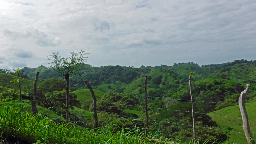
The greenery of Panama has taken me aback. It is incredibly beautiful here. The central area is mountainous and the coastal regions have lush greenery all the way to the beach. The greenery is because it rains in the summer. It has rained a little bit just about every day. But, nowhere near the violent electrical storms on the other coast.
This grass looks good enough to eat
Outside of the booming modern metropolis of Panama City, the small towns are colorful and little bit dilapidated. They have a character. The Panamanian people in these towns are incredibly friendly. People who speak English love to practice with us. Every conversation begins with some small talk such as how you are doing or something about the hot weather. Only then, after this small talk, business is conducted. Some tourists tend not to notice this formality and jump straight into asking a question like how much is something or just giving a waiter an order without saying hello first? The Panamanian people think this is rudeness. Cindy and I both agree we want to live in a polite society when we grow up.
Cabs are inexpensive. They’re not as cheap as the ones in Colombia but nonetheless very reasonable. From our marina to our local town is about 15 minutes, the fee is US$6.00. Taxis are everywhere since it is expensive to have a car in Panama. Public transportation and taxis serve the bulk of the population even in the most rural areas. One of our taxi drivers joked with us about the warm weather. He said, “When it rains in Panama, the Panamanian people feel cold. If a Panamanian ever leaves Panama for someplace where it snows, they die.”
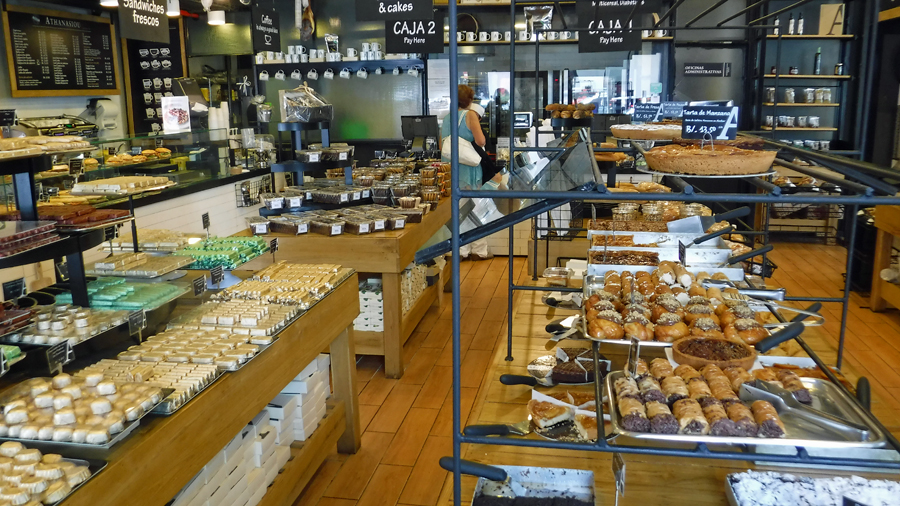
We stumbled across this awesome bakery called Athanasiou
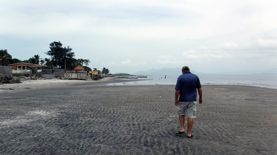
Walking at low tide (the tides are about 15 feet) at Punta Chame
One of the great things about cruising is my knowledge of geography has become much better. As we look westward, I am learning the names of islands I had no idea even existed. After sailing the Caribbean, I now pride myself on the fact I can name every island in the West Indies chain. My knowledge of geography wasn’t that bad to begin with since I often stared at atlases or globes as a kid and pondered traveling to far off places. Well, at least I thought my geography was getting better. It seems as though my education has taken one step forward and two steps backwards.
I learned recently many schools outside of the USA and Europe teach there are only five continents. I was taught there were seven continents by the fine British public school educational system. I’m not sure if they have since adjusted but they didn’t send me a memo explaining how the number of continents might have since changed. The continents are: Africa, America, Antarctica, Asia, Europe and Oceania. Antarctica, that is a part of the seven teaching, is not considered a continent because it has no permanent population according to the five continent theorists. A person telling me this cited the flag of the Olympics as a proof source and explained how the five circles represent the continents. Well, I thought, if it is good enough for the IOC, it must be true. I’m jumping aboard. This all came about because I referred to something as Central America. In previous posts on this blog, I have also talked about crossing from North America to South America in Panama.
Panamanian’s are taught there is one continent of America. There are no central, north or south. Before the man-made canal, it was one piece of land referred to as America. It was mistakenly named America by Martin Waldseemuller in 1507, a map maker who didn’t get the memo about Christopher Columbus and thought it was Amerigo Vespucci who discovered the new world. I wonder if he too was a product of British education. So, today we very likely could have been referring to America as Columbusville had it not been for Mr. Waldseemuller . This brings me to a real pet peeve of Panamanians. They do not like it when people from the USA refer to themselves as American. They respond by saying, “We are all American”. Isn’t it interesting how something we are all taught at a young age becomes a rift later in life?
I was also taught in the British school the largest island in the world is Australia. Ask any Australian this and they will agree. In the USA, Greenland is considered the largest island, even though it is about one third the size of Australia. When in the USA, I questioned this. I was told by my American (sorry) USAian friends, Australia is a continent, not an island. But is it? 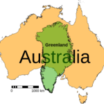 Doesn’t Australia clearly meet the definition of an island? From Merriam-Webster’s dictionary: “A tract of land surrounded by water and smaller than a continent”. It seems as though almost everyone is in agreement Australia is located in the continent of Oceania. Even the people who don’t agree whether there are five or seven continents agree there is a continent of Oceania. So how come Australia isn’t the largest island in the world? If you still think Australia is a continent then ask yourself what color of the Olympic flag represents New Zealand? Yes, it is the color representing the continent of Oceania that includes Australia. Do you see now how this is all coming together?
Perhaps someone could enlighten me as to how many oceans we have nowadays. Is it still seven? Or, have we combined the North/South Atlantic oceans and the North/South Pacific Oceans to become five like what was done with America. Since we are sailing, it’d be nice to know where we are. On the off chance we need to call for help, knowing what ocean we are located on would be a very good start to giving directions to someone hoping to find us. Oh crap! I just Googled it. Now there are only five oceans, not seven! What the hell is happening?
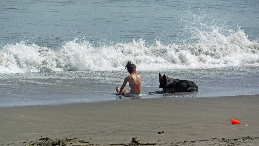
A lady and her dog play in the surf at Las Escobas del Venado – A great way to spend the day, don’t you think?